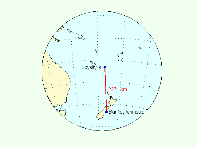
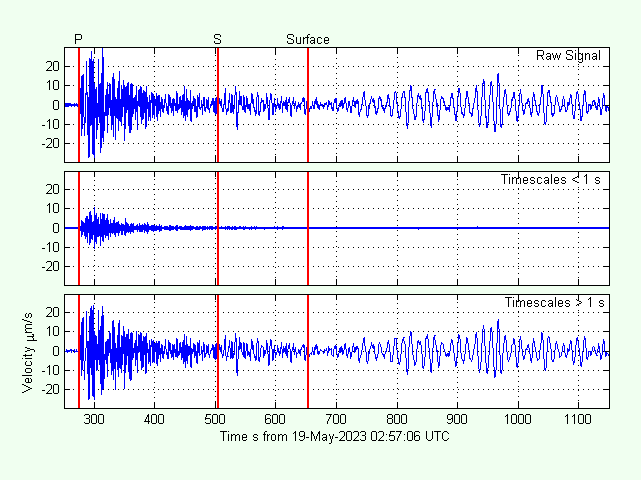
The EQ Mw 8.2 at 33 km depth at Loyalty Islands this afternoon produced beautiful Rayleigh/Love waves at my RS1D RC144 on Banks Peninsula.
3 Likes
That is great, what software did you use to do the diagrams/globe?
1 Like
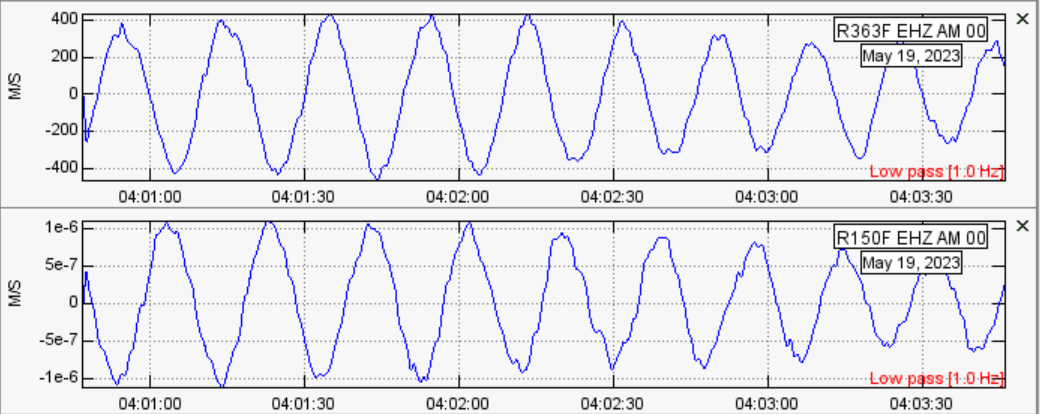
Same here in Scotland, we got some pretty long oscillation (around one hour) after the surface waves reached us ~80 minutes post-event.
what software does that path analysis?
and
Are you near Castle Douglas? I visited there once ![]()
2 Likes
In points:
-
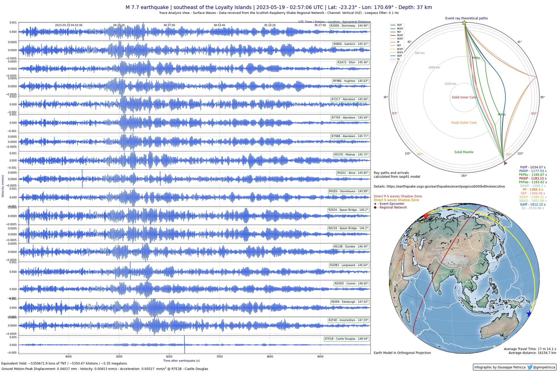
They raypaths are created via a Python module called ObsPy: https://docs.obspy.org/
-
On the other side of Scotland from Castle Douglas, I’m in the Hebrides.
The software I use is Matlab. The map was produced by a package called m_map.
1 Like
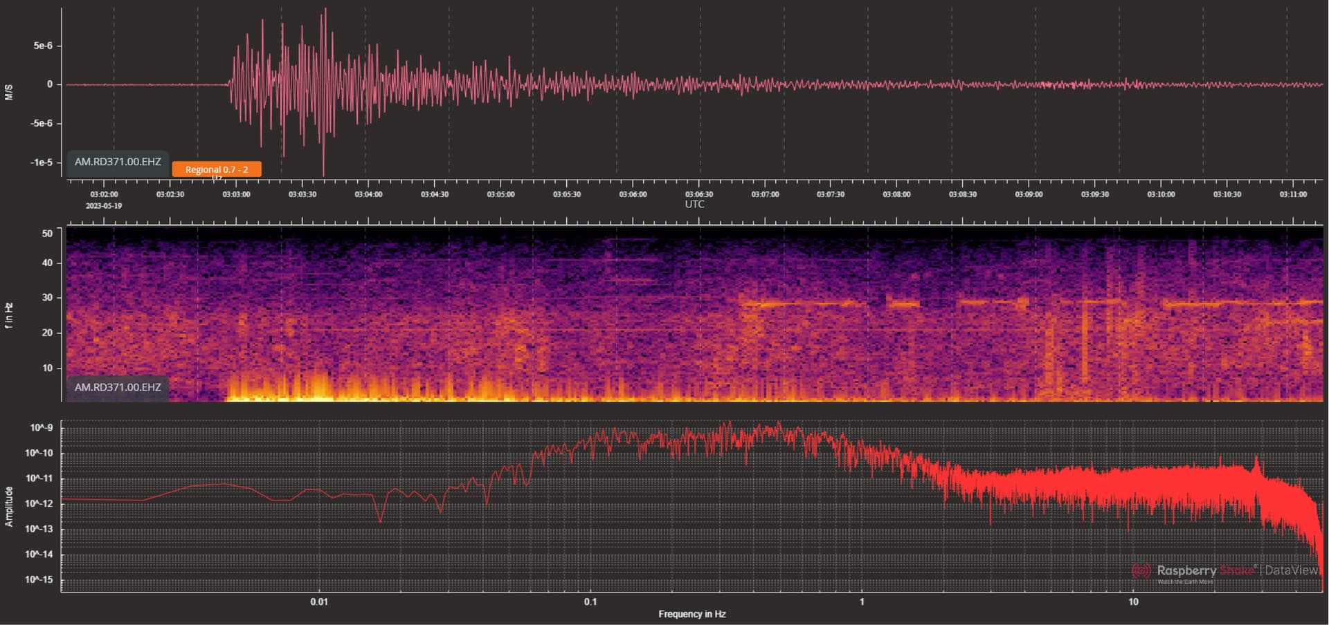
I don’t know how to get the fancy maps you all have yet lol but here it is from my shake in DataView
2 Likes
Thanks.
And the quake involved the New Hebrides subduction zone.
1 Like
Thought I would mention the quake also produced tsunami waves from the BOM Tsunami Bulletin:
TSUNAMI DETAILS:
The following sea level gauges have observed a tsunami, heights refer to wave
amplitudes (positive wave values):

Name                  Country       Lat     Lon      Height (m)  Time (AEST)
Lifou Island          NEW CALEDONI  20.90S  167.28E  0.15        19 May 02:00 PM
Ouinne                NEW CALEDONI  22.00S  166.83E  0.22        19 May 02:10 PM
Port Villa            VANUATU       17.80S  168.31E  0.22        19 May 03:00 PM
Hienghene             NEW CALEDONI  20.70S  164.94E  0.04        19 May 02:45 PM
DART 5501005          NZJ,NEW ZEAL  26.67S  163.96E  Detected    19 May 02:40 PM
North Cape            NEW ZEALAND   34.41S  173.05E  0.32        19 May 03:45 PM
DART 5501004          NZD,NEW ZEAL  36.10S  178.60E  Detected    19 May 03:45 PM
Lautoka               FIJI          17.50S  177.50E  0.05        19 May 03:20 PM
Great Barrier Island  NEW ZEALAND   36.19S  175.49E  0.33        19 May 04:30 PM
East Cape             NEW ZEALAND   37.50S  178.17E  0.11        19 May 04:40 PM
Lord Howe Island      AUSTRALIA     31.52S  159.06E  0.10        19 May 03:45 PM
Gold Coast            AUSTRALIA     27.90S  153.43E  0.24        19 May 05:00 PM
Port Kembla           AUSTRALIA     34.50S  151.00E  0.11        19 May 05:45 PM
Mare                  New Caledoni  21.55S  167.88E  0.15        19 May 02:00 PM
Thio                  New Caledoni  21.61S  166.24E  0.10        19 May 02:20 PM

REPORTED TSUNAMI IMPACTS:
Location: Norfolk Island
Impact Type: Unusual currents and waves
Approximate Observation Time: 05:45 19/05/2023 UTC
Details: Unusually high tides reported from Norfolk Island in Emily Bay and
Kingston Pier
1 Like