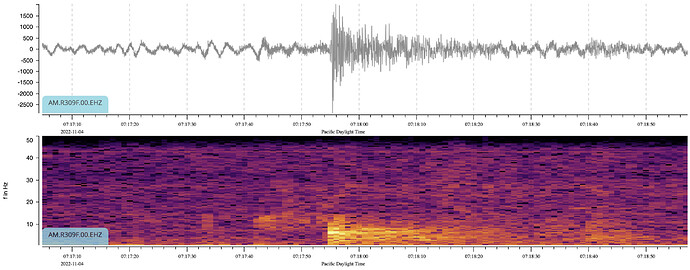
Over the past few days I have seen a couple of fairly small earthquakes which appear to be local.
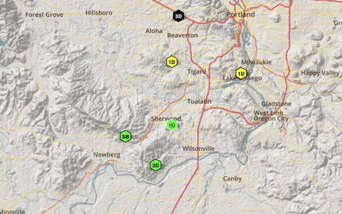
This is the area:
The stations of interest are mine (SB, North of Newberg), the 3D to the East, and the 1D to the North-West. I both cases the signal was much weaker on both the 3D and 1D stations. The 1D station shows a later arrival, so the even looks like it occured to the south.
For reference, the distance between the SB and 3D stations is ~3.5 miles.
There is a fault which runs through Newberg (The Newberg Fault, would you believe?). USGS shows it are inactive, but I suspect that is because it is not closely monitored and hasn’t generated any significant event for some time.
I have a question about the recorded data:
Looking at the frequency domain plot, the first (weaker) signal starts at about 07:17:42.
The second, stronger signal starts at about 07:17:54.
Assuming these are P and S waves, that would make the event quite a distance away, So far that I have my doubts about these actually being P and S for the same event.
Any thoughts on what I am actually seeing here?
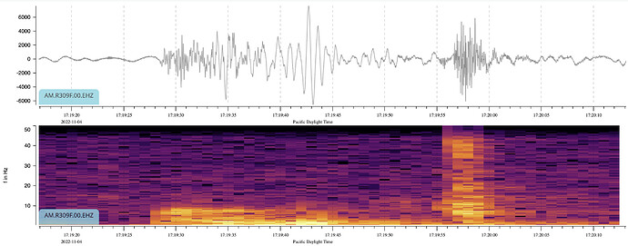
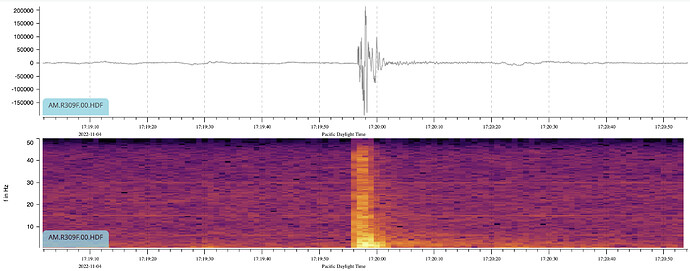
EDIT: This evening, there was a loud noise. Sort f like thunder, but not quite. A couple of minutes later the local FaxeBook group lit up with reports from right across the town of people hearing the noise and their houses being shaken by it (I didn’t notice any sort of shaking here). This really doesn’t look like an earthquake to me. Again, detected by the other two stations, but nothing that I could see beyond.
Also showed up as a good strong signal (at least part of it did) on the infrasound channel:


