Dear RaspberryShake members,
I’m curious about what kinds of research can be done using the network of raspberry shake 1D, can you share your ideas, please?
Dear RaspberryShake members,
I’m curious about what kinds of research can be done using the network of raspberry shake 1D, can you share your ideas, please?
Well, one thing you CANNOT do is to use the archived locations of the RSs for research. Reason: the locations have been obfuscated and are inaccurate by several hundred metres.
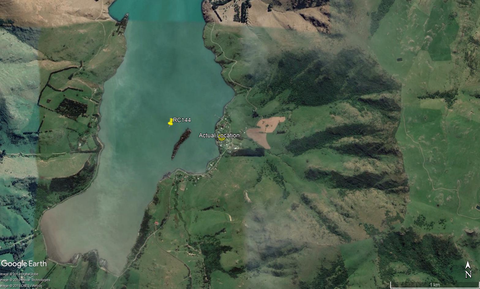
Here’s my RC144. It’s actually on land, but according to data from the archive it’s in the middle of the bay.
It is the case. But, if you have true GPS coordinates then I think it is not the problem.
hi there,
just want to add some information in regards to your observation that research CANNOT be done when needing to use the archived locations. while the devil is in the details, it is simply not true to say that no research is possible even when the instrument locations are off by several hundred meters.
there are a few reasons why this is true, but first and foremost, being related to just how accurate a calculated result needs to be in order to still be useful. accuracy is seductive, but in a lot of areas, it’s not necessary to come to a conclusion that is interesting anyway, regarless the fact that it’s technically wrong.
another, more significant factor is that when doing research that uses instrument locations, there are other elements and variables used in the math formulas that are themselves quite inaccurate. for example, computing EQ locations requires the use of velocity models, i.e., how quickly each type of seismic wave travels through the earth (all the parts of it). except that these veolocity models are, at the end of the day, gross generalizations of the actual reality. while they are getting better by becoming more and more localized, they will never be entirely accurate, that is, they are wrong.
but again, this isn’t really the point. rather, for whatever analysis is being done, for whatever purpose, using whatever data (that may be not absolutely precise), what exactly is the loss in the computed result? again using EQ locations as an example, does any seismologist care that a computed EQ location might be 1Km off? does it matter if the depth is actually 635Km instead of a computed 620Km? does it change the science? perhaps some might say yes, BUT, they have no choice but to work with what they have.
in fact, it is not even possible to say that the instrument locations being off by several hundred meters will make any analysis result less accurate. it’s entirely possible the result will be more accurate since the incorrect location might actually offset the other inaccurate variables being used in the equations.
instead of simply making absolute statements, then, which are provocative and absolutely not absolutely true, please explain your specific use-case:
and, to restate the original reason the locations are obfuscated: while it seems you don’t have a problem with advertising the exact location of your house to the world, this simply isn’t true for the most of our end-users. in fact, according to the EU and GDPR, if we were to do this without prior permission from the end-user, we would be in violation of EU law and would be fined accordingly, a result we will avoid in favor of producing obfuscated instrument locations when we already know the margin of error provided by velocity models is worse.
to be clear: i will be the first here to state that i am not someone who knows every single analysis possibility which employs instrument locations in any equation. perhaps there is an equation out there in which all the variables are known to be absolutely true, while the instrument location is the only one that’s inaccurate. but in that case, computing the margin of error is trivial.
and the question still remains: this known margin of error renders the analysis completely useless?
cheers,
richard
Having been a scientist for 40 years and having more than 50 journal papers to my name, all I can say is that I’d be uncomfortable publishing results using data that I know to be wrong.
Our programmer is developing a Deep Learning fuzzy logic algorithm initially for research. We need historical data on Long, Lat, Magnitude, Depth - and anything else he can get, hopefully with the station name to calculate P and S wave times. Does anyone have or know where we may source this? Or is anyone knows how to ‘stream’ data from our own units??
Cheers
Ashley